P.O Box 14, Uganda | Tel: +256-772-408464
| E-mail: [email protected]

Location & Size
Pallisa is one of the districts in the Eastern region of Uganda. It is bordered by Serere district in the Northwest, Ngora in the North, Kumi in the North East, Bukedea, Butebo and Budaka Districts in the east, Kibuku and Kaliro in the south and Namayingo in the west. It lies between latitudes 0045’N and 10 05’N and longitudes 33047’E and 34005’E; with an average altitude of 1,050 above sea level. The District headquarters are situated in Pallisa Town and the District has a total area of 1,956 km2 (755 sq mi) of which land area is 564 km2 (604 sq mi)
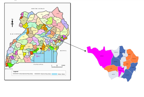
Map of pallisa District
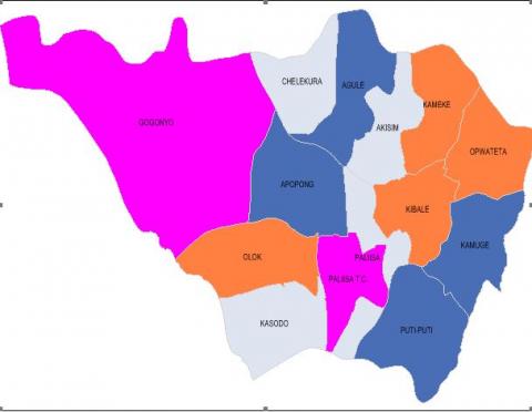
Map of pallisa District showing Lower local Governments